Sinai Peninsul
Dahab
 Click below for an interactive satellite view of our anchorage:
N 28° 28.36' E 034° 29.50'
Passing the southernmost point of the Sinai Peninsula, Ras (Cape) Mohamed (the dividing point between the Gulf of Suez and theGulf of Aqaba ), and watching numerous dive boats at Shark Observatory and Beacon Rock.


Dahab
El Kura
SY "Kamu II" at anchor, west of a low sandy spit in the eastern part of the bay, at 10 m of depth, on sand and coral (near the big, rusty mooring buoy).N 28° 28.36' E 034° 29.50'
Passing the southernmost point of the Sinai Peninsula, Ras (Cape) Mohamed (the dividing point between the Gulf of Suez and the

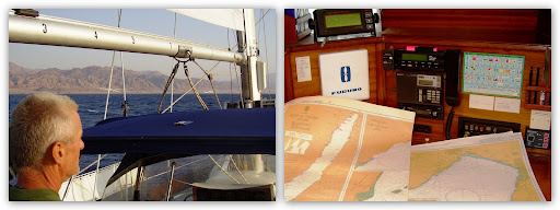
Entering the 1,800-m deep Gulf of Aqaba, which varies from 7 nm to 12 nm in width, and is actually part of a rift (a crack in the earth’s top layer) that stretches for some 6,000 km starting at the Dead Sea on the border between Israel and Jordan, continuing across the Red Sea, Ethiopia and Kenya all the way down to Mozambique in southern Africa.

Motoring through the Grafton Passage of the infamous Straits of Tiran (from S to N), with its many threatening reefs and conspicuous wrecks, and encountering huge swell on the nose of SY “Kamu II” thus getting a first taste of what we could expect a bit further up N in the Gulf of Aqaba.
Bumping into 40 knots of wind on the nose and three metre breaking waves which forced us to find shelter in the lee of El Kura where we had to sit at anchor for seven days, waiting for a better weather window.

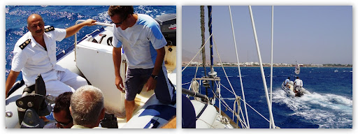
Meeting Harry, the very helpful and friendly German owner of the Harry Nass Surf Center Dahab +20693640559, who generously supplied us with fresh fruits and vegetables whilst we were waiting at anchor for more favourable winds.

Click below for a summary of this year's travels
2006 Map Konni & Matt
Click below and see more Konni & Matt Pictures
2006 Map Konni & Matt
Click below and see more Konni & Matt Pictures